This is a long and involved piece of investigation. But we do provide a summary at the end for those who don't like to read too many pages.
And we've even put some pictures in for you, too Councillor Chapman :)
And if you take nothing else from this whole piece but one thing, make it a mental note to curb your cut and pasting. Ctrl-C + Ctrl-V can cause the entrenching and perpetuation of mistakes, errors, obfuscation, evasion and deceit. It can cause all of the wrong things to remain unchanged and unchallenged in all the wrong places...
(More on the hydrology of Hirds Pit and Heathcote will be found here soon.)
***
The Costerfield Operations have been permitted by the
regulators to extract and retain more water than Mandalay Resources can dispose
of.
It is the regulators who have allowed this excess of water
to exist. And it is they who have over-facilitated this mine's disposal of
"stormwater" and "rainfall run-off". It is the regulators
who have not required a weather station to enable the calculation of
site-specific, weather, climatic and therefore evaporative capabilities. A weather
station might have shown which way the wind blew and that's a whole other Pandora's Box.
Despite the fact that the Splitters Creek Evaporative
Facility had not even been approved, in 2013 Goulburn-Murray Water (G-MW)
signed off on an increase in the amount of groundwater Mandalay was allowed to
extract, from 179ML to 700ML per annum. A more than tripling of the allowance.
And the mine was at that time trucking 1.2 ML/day (later increased
to 1.4 ML/day) from Costerfield: "11.2 km along the Heathcote-Nagambie Rd
and Northern Highway to the Emu Downs truck depot on Pianta St, Heathcote"
according to a consultancy report.
Listen to one of the things Sinclair Knight Merz (SKM), one of the
mine's preferred consultants, said in that report to make this trucking appear
acceptable to the regulators: "This is an existing heavy vehicle
route."
No it is not! Not just that! It is a public road (along which locals travel to and from Heathcote and Nagambie) and a public highway (carrying general traffic to and from Bendigo). Over
40 trucks per day, each laden with 30,000 litres of toxic groundwater (and what
else?) hammered along these roads - and we mean hammered; you should have tried
to keep up with them! - five days a week with their toxic loads. The road remains a mess of pot holes and patches and crumbling edges. No one is fixing it up.
That approval comes in the form of what is ironically termed
a Pollution Abatement Notice. What level of "abatement" actually took
place is unclear. The pollution was
moved from where it was supposed to be dealt with, to another place, closer to more
residential properties and the people who live there. It's only a short
walk to the main street in town. The highway.
Dilution is the solution to pollution.... no it's not!
Public concern regarding the dumping of this toxic groundwater from the basement
aquifer in Costerfield drove the production by SKM of what was termed a
Risk Assessment (5MB pdf) for Mandalay Resources
to satisfy EPA and DSDBI and CoGB and whoever else needed easily convincing.
Of particular concern to residents was the
possibility of the contaminated water leaking and leaching from the Pit into
the local aquifer system and thus polluting the groundwaters in Heathcote. The
SKM Risk Assessment attempts to these assuage fears by asserting that
Work by Golder Associates (1996 [!])
in [a] similar geological environment in
the Costerfield area determined hydraulic conductivities for the fractured rock
aquifer in the general area of 0.1m/day for the fracture systems, and 0.01
m/day for the country rock. Similarly Golder Associates (1996) determined
specific yield values for the fracture systems and country rock of 0.001 and
0.1, respectively.
Acknowledging that fractured rock
aquifers are highly anisotropic, these data appear to be consistent with the
typical range for a fractured mudstone, representing a confined to
semi-confined aquifer system, hence it is expected that the basement aquifer in
the Heathcote area would be characterised by similar hydraulic properties.
Moreover surveys of water levels in the pit in 2012 showed a direct correlation
between pit water height and the volumes of water being discharged into the
pit, suggesting that there is minimal seepage into the groundwater. Hence this
would appear to confirm low hydraulic conductivities, similar to those
calculated by Golder (1996). [Emphasis added.]
Except that as SKM also notes:
The extent to which fractured rock
aquifers store and transmit water is largely a function of the size and
orientation of the fractures and the degree to which they are interconnected.
For this reason fractured rock aquifers are hydraulically highly variable and
difficult to characterise without specific field investigations (p. 52, emphasis added).
And that:
The analytical assessment
undertaken by SKM (2013) identified low risk of potential groundwater impact on
McIvor Creek after 10 years due to lateral migration of potential groundwater
impacts from the Open Cut, even when a sensitivity analysis was undertaken
using highly conservative input parameters (p. 23, emphasis added).
Oh, and except that Heathcote
is NOT Costerfield.
An analytical assessment is one that subjects previous
extant information to examination to predict outcomes. It does not necessarily utilise
“specific field investigations”, but relies on other collected data. So here is
SKM’s “Reliance statement”:
In preparing this report, SKM has
relied upon, and presumed accurate, certain information (or absence thereof)
provided by the Client and other sources. Except as otherwise stated in the
report, SKM has not verified the accuracy or completeness of all such
information… SKM derived the data in this report from a variety of sources.
This is an analytical report. No test pits or bores were
sunk by SKM; no water sampling done on a site specific basis by them, etc. Presumption, unverified accuracy. You
get the idea. SKM referred to and relied on previous documents… provided by the
Client.
And the documents they referred to, in order to inform their
analyses, are nearly all internal consultancy documents produced over the years
by the various consultancy firms employed by the mine in Costerfield, with the
imprimatur of the regulators, specifically to facilitate expanded mining. In Costerfield.
We do not have access to many of these documents, of course,
and so we were forced to limit our search for geological and hydrological data
to another database: the Internet. And we found this:
The Heathcote mine (Hirds Pit) is
located to the immediate west of and partially within the Heathcote greenstone
belt, in an area of notable flexure along the Heathcote Fault Zone.
Mineralisation is hosted along a (sheared?) contact between Ordovician sediments
and Cambrian sediments, localised along a NE striking, SE dipping reverse
fault. Better ore zones are developed along shallow east-dipping ‘flatmake’
quartz veins associated with the reverse fault. To the SW of the Hirds Pit, a
series of doubly plunging anticlines and synclines are developed within the
basal unit of the Ordovician (Lancefield, analogous to Fosterville). A drive
around this area located quartz vein breccia? proximal to the hinge zone of the
Wild Duck Anticline. This area is also located along the southern
projection of the Fosterville Fault, at a very notable megakink
(Tooborac Megakink) along the Heathcote Fault Zone. This kinking would have
been active during the later deformational event (Tabberabberan Orogeny), as
evidenced by coincident deformation of both the Ordovician sediments to the
west and Siluro-Devonian sediments to the east. The orientation of such a kink
could provide a major dilational site during (sinistral) strike-slip movement,
along the southern projection of the Fosterville Fault. This region has
many analogies with Fosterville (host rock, cross-cutting interpreted
structures, felsic dyking etc). (pp.
5-6, emphasis added)
“A drive around the area located"… something! What a radical concept!
And there’s this from page 3:
Previous exploration
Approximately 350,000oz AU has
been produced by the Silurian-Devonian
sediments during predominantly historic and some recent mining activities
within the Melbourne Zone of the project area (Nagambie, Ballieston, Whroo,
Redcastle, Graytown, Costerfield, and
100,000oz from the Ordovician
sequences within the Bendigo Zone (Heathcote). [Emphasis added.]
7.2 Ordovician
The Castlemaine Supergroup is the
name used for the thick sequence of Lower Ordovician quartz-rich turbidites of
the Bendigo Zone (Cas & VandenBerg, 1998). It was defined largely on the
basis of exposures around Castlemaine. In Heathcote these rocks form the main
part of the Paleozoic bedrock west of the Heathcote greenstone belt, but also
occur as fault slices within the central segment of the Heathcote greenstone
belt.
Boundary relationships: where the
contact is well exposed in Kilmore, the Castlemaine Supergroup conformably
overlies the Goldies Chert. In Heathcote, the turbidites lie directly on
Knowsley East Shale in the main pit of the Hirds/Red Hill prospect.
And this can be contrasted with Section 7.3, where we find:
7.3 Silurian-Devonian
Costerfield Siltstone – Slc (Thomas, 1937)
Distribution and reference
locality: the siltsone is restricted to the core of the Costerfield
Dome centred around the Costerfield township. A type locality is not assigned
due to sparse exposure, but samples can be obtained from the large mullock heap
which surrounds the former site of the Costerfield main Shaft (antimony mine)
adjacent to the Costerfield township, and a good reference section for the
sandier upper portion of the formation lies in the headwaters of an unnamed
tributary to Wapentake Creek.
The Cuffley Lode is situated in
Costerfield which is hosted in the Silurian Costerfield Siltstone.
So SKM appear to have employed data gleaned from a distinct and non-“analogous” geology in order to declare that a – geologically – completely distinct fractured rock aquifer system in Costerfield has a permeability
rate comparable to that of the geology in Heathcote, in order to justify
dumping toxic groundwater there. For SKM, recall, Costerfield is “[a] similar
geological environment”.
Sometimes pictures are an easier way to present these
things. This is a detail from the map accompanying Geological Survey 108,
both available on the DNRE website here. It’s a big file - 25MB - hence our editing here.
This map is oriented to north. To the west (left) lies the Ordovician
geology of Heathcote in light blues. To the east (right) in the purples and
pinks is the Silurian-Devonian Costerfield. They are separated, east from west,
by the Heathcote Fault running north-south, along which the McIvor Highway
runs.
But so, too, does the McIvor Creek. In a fault zone.
Now, we are not
hydrologists, but we do have some experience in the analysis of
documents for government, business and academic production. And matters of fact
and the consistent internal logic of an argument are two of the most important
requirements for an adequate analytical outcome. To imply - as has been done
here, with the citing of Golder Associates' 1996 Bombay-Costerfield Open Pit Additional Modelling for Pit-Refilling
report for Australian Gold
Development Pty Ltd - that one geology is "similar" to another when it is in fact
a completely distinct geology (Zones, as well, we think), and to then draw from this misrepresentation
predictive analytical conclusions, without providing justification would
seem to present a fundamental flaw in the argument that the potential impact of
leaking of toxic water from the pit is of “low risk”.
There is not a single mention of the relative geologies of
either Heathcote or Costerfield – let alone Fosterville – in the SKM report.
While groundwater flow in
fractured porous media occurs mainly through fractures, much of the water
contained within these aquifers is stored within the matrix. This has important
implications for the movement of contaminants or other dissolved substances. Even if the permeability of the matrix is
very low, diffusion will cause mixing of solubles in water flowing through the
fractures with those of the relatively immobile water in the rock matrix. In
practice, this means that dissolved substances appear to travel more slowly
than water.
And the geology in Heathcote is actually characterised by siltstone, sandstone and mudstone… not
merely mudstone. No mention of "sandstone" or "siltstone" appears in the report.
But the less permeable “mudstone” is front and centre (see the SKM PEA, p. 53).
We are not suggesting, here, that this is a deliberate
misrepresentation. It may be mere clumsiness or laziness that caused SKM to
rely on internal documents to inform its assessment. Or not. It may be – as we say, we are not geologists – that these two distinct fractured rock aquifer
systems can be readily compared.
But it certainly doesn’t appear that way. And there is no information provided
to support this implication. And there seems to be credence given in the literature that this difference is of some import. And one would have hoped that at least a reference
would have been made to the Geological Survey of Victoria. And some mention of
geology... neither the word 'Ordovician' nor the word 'Silurian' appears in the Risk Assessment.
Oh, and then there’s the issue of defining “groundwater”.
Hird’s Pit, prior to the dumping, ahem, discharging there of
toxic, heavy metal-laced water from the basement aquifer at the Augusta mine in
Costerfield, was a disused open cut mine filled with water from the Heathcote
alluvial aquifer and rainwater.
The SKM PAN Risk
Assessment has this to say:
Notwithstanding that water from
the Augusta Mine is predominantly groundwater mixed with some rainfall runoff
and that the water in the Heathcote Open Cut is predominantly groundwater with
some rainfall runoff, impacts on the water within the pit need to be evaluated
against surface water criteria rather than groundwater criteria. (p. 68)
This is the sign at Hirds Pit. It's a Health Hazard.
This is a blatant misrepresentation and underplaying of the
actual conditions by SKM. The water being trucked from Costerfield was sourced from the
basement aquifer of the Augusta Mine and contains highly elevated levels of the toxic heavy metal
antimony, and rainfall runoff – whatever that may be – from a Silurian-Devonian
geology. It was discharged into the Heathcote Pit where the extant groundwater
and runoff – not contaminated with the same high levels of antimony and other
metals because it is sourced from a totally distinct, Ordovician geology – is
used for the dilution of the pollution. That’s the solution.
So, if a comparison of the two geologies of Heathcote
and Costerfield is like comparing apples with oranges, then the comparison of
two “groundwater[s] mixed with some rainfall runoff [one wonders who was doing
the ‘mixing’]” would be like comparing bicycles with fish. The undermining conflation
of these two groundwaters could, if it were deliberate, be seen to border on the fraudulent. Especially when one
considers Table 4-1 on page 51 which declares the “Source of groundwater” for
"Discharge" to be:
That’s right, the Brunswick Pit and Augusta Evaporation Dam.
In that order. The Brunswick Pit is supposed to be a decommissioned tailings storage facility (TSF) that has been left to accumulate stormwater for ten years.
How can a Tailings Storage Facility be a “Source of groundwater”?
This was not an "emergency", this was an exercise in the facilitation of off-site water disposal.
In Figure 2-2 of the Risk
Assessment the Brunswick TSF is graphically represented thus:
It is clearly delineated as a TSF – black in the legend,
“mine water features fresh/tailings” – and a separate "Stormwater Collection" dam
is indicated, too. Here’s what google maps sees:
There is stormwater runoff – whatever that is – all over
that segmented TSF. And “mine waters”, too, it would seem. The "Stormwater Collection" dam is a heap of something. If you look closely you can
see where breaches have been made to open up the Facility. Where the “Tailings” are. And that’s where the
water that is mixed with the toxic groundwater has been coming from.
The Brunswick Pit is not the Brunswick Tailings Dam . We humbly withdraw this section and apologise for the imputation. This section...
(One wonders whether this misleading and misrepresentative
work by SKM would meet the “more
robust integrity compliance” required by SKM to fulfill the “two
and a half years probation” imposed on it by the World Bank for “improper
payments” in Asia. To their credit, SKM did self-report and were
considered open and co-operative. Therefore they received probation in July 2013. And
that same month produced the Splitters Creek Report. And were then bought out by Jacobs Ltd in September 2013. Just in time to complete the PAN Risk Assessment job.
But we shouldn’t be too surprised at this accumulation of
what we shall generously term 'seeming ineptitude'. SKM have already been noted in the Victorian Legislative Council for
the “timeliness” and “quality” of their work.
“Dodgy” was the description applied by the Hon Mr Gavin Jennings, the then Shadow Minister for Health, in
response to receiving a copy of a report commissioned by the Department of
Health into the financial costs of a carbon tax on that sector. The report,
entitled, Impacts of Carbon Pricing on the Victorian Health-Care System, was produced – to spec and at short notice, it would seem – by SKM.
The following is part of an exchange regarding this report recorded in Hansard at p. 3343:
Mr Jennings begins by noting a $153 million discrepancy in
one of the calculations in successive drafts available to the media and to Parliament
respectively. And then:
One must question how legitimate
and valid this document is when it has been available to Parliament for just 1
hour prior to this debate occurring today.
Even though the minister said it
has been in preparation since 2011 and that in March he gave a drop copy to the
Herald Sun with a different number, if you look at page 4 of the document
tabled today you see that it indicates that the cost attributed to the carbon
tax is in the order of $13 million out of a $9.332 billion budget, which is 0.1
per cent. On the same page it goes on to indicate that during the life of the
estimates contained in this document the figure may rise to 0.2 per cent by
2020, even though there is no methodology in this budget about what the growth
in the hospital budget will be. No description of the financial estimates of
the projection of the growth in hospital budgets is contained within this
document.
Have a look at how fair dinkum
this is. The people opposite are going to stand up and defend this document.
They should have a damn good look at page 43, which has two things on it. Table
5 at the top of the page indicates that by the out year 2020 the total cost to
hospitals in Victoria, if all the projections are right, will be $18.996 million.
If you then look at the graph below it, which is a sectoral analysis of the
costs in the budget from 2013 to 2020, you see that it does not even match up.
In fact, the scale at the bottom of that graph shows that the number does not
even get to $18 million, let alone $18.996 million.
In terms of the methodology and
quality of the work, if my secondary school child produced a document as valid,
rigorous and comprehensive as this I would have a go at him for delivering
inferior work that is riddled with inconsistency. It does not justify its
method or explain how it gets to an end point. In fact I would expect that if
the minister is paying money for this piece of work, he should at least see
that the critical page, page 43, has the same number in terms of costs
attributed to the table and the graph. That is the fundamental issue he is
trying to convince us of.
Later Mr Jennings refers to the report as
This atrocity in terms of
propaganda on the Victorian electorate is very poor form by a minister who has
actually paid for and commissioned a dodgy report that has given him dodgy
numbers.
***
In keeping with Mr Jenning's reference to school children's work, we shall now bring up the matter of a number of reports produced by SRK Consulting, another consultancy firm employed by Mandalay Resources. In September of 2013, while SKM were busy working on the PAN Risk Assessment and EPA was rubber-stamping Pollution Abatement Notices, SRK produced the Preliminary Economic Assessment for the mine's expansion into the Cuffley Lode.
This expansion required the construction of a new vent and ventilation system. The Cuffley Vent.
The report was prepared to satisfy Canadian Stock Exchange requirements for the disclosure of details of mineral extraction endeavours by Canadian companies. Much of it is cut and pasted from the NI43-101 report of the previous March.
It would seem that some of the material has been cut and pasted from much older material, too. For example, as the Chief Inspector of Mines was quick to point out to us - when he assumed it was OUR mistake! He's been very quiet since - Victorian Mining is legislated under the Mineral Resources (Sustainable Development) Act 1990 and the current iteration of the Occupational Health and Safety Act is from 2007.
So when the report states at 16.7.3 (p. 149):
Airflow Requirements
The Victorian Mining Act 1958 doesn't stipulate any minimum
ventilation requirements, but the Occupational Health and Safety Act
2004 stipulates...
...it is referring to outdated Victorian legislation. One would suspect then that this snippet was lifted from a document produced between 2004 and 2007 when the latest OH&S Act took effect. As John also told us, the Mining Act was repealed on 14 October, 2010. Cut and paste.
It looks like it gets proofed a bit and juggled around a little between each re-presentation, but not too much. So we have the March 2013 NI43-101:
and the Costerfield PEA from September 2013
and the March 2014 NI43-101
Members of the public.
Producing NI43-101s looks like a good job for an editor... wonder what it pays?
Somehow the Mining Act 1958 lost a capital letter in 2013, but it got it back over Christmas. And a paragraph was separated off. The "the importance" of occupational health and safety was styled-up in early 2013 but had returned to standard script later in the year. The ungrammatical "reasonable practicable" hasn't been fixed. Ever. Probably in the original...
And because these pieces of information were readily available and easily transferable from one document to another - and had applied to the mine since 2004-2007 it would appear - someone just pasted them in and forgot to consider the people of Costerfield. EPA should have been aware that there would be an increase in dust generating activities and therefore a requirement to apply the EPA SEPP for Air Quality Management for this mine. But why would the EPA do anything if it didn't absolutely have to?
The only reference to any EPA responsibility comes in the section on Noise, where it is noted that "Monitoring is carried out in accordance with EPA's Victoria SEPP N1 policy". But not carried out by EPA. The SEPP does not appear in the list of references, nor does any other mention of EPA.
No further action or examination was deemed necessary because SRK had cut and pasted the "main objectives" of an update review undertaken on behalf of the mine by yet another consultancy firm, AJ Bruce Consulting Pty Ltd. There are no "objectives" here that align with anything that could be considered environmental or social responsibilities. It is all technical.
The environment is not a priority for the mineral extraction industry. It wants to mine. We all understand that. And we must deal with it. That is why we have - had - an EPA. And regulators.
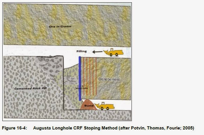
The disdain and levity with which the Victorian regulatory system appears to be viewed by the consultancy industry of late can perhaps be illustrated with these pictures from the three reports snippeted above - all three. These pictures are in each of the versions, including the two for the Toronto Stock Exchange. It appears as if, in line with Mr Jennings observation regarding an SKM document, that the authors of the report have let their children provide Figures. What the heck is this?
"after Potvin, Thomas, Fourie; 2005"; "after Marshall, 2010"? It looks suspiciously like someone taking the piss.
But wait, that's not all.
We've been interested here in the disposal of excess groundwater, so let's see what these reports have to say about that. From the PEA document at pp. 156-7:
20.1.3 Water Disposal
The disposal of groundwater extracted from the mine workings is a critical aspect of the Costerfield mining operations. The current approved Work Plan does not allow for off-site disposal of groundwater or surface water, except in the event of an 'emergency'.
The climate in Central Victoria enables water to be removed through evaporation. Average pan evaporation is approximately 1,400 mm per year according to the nearest Bureau of Meteorology monitoring station in Tatura. Mean rainfall in the area is 576 mm per year according to the monitoring station at Heathcote, with the highest annual rainfall recorded in 1973 as 1,048 mm. Higher than average rainfall was recorded in Heathcote in 2010 and 2011 with 979 mm and 759 mm respectively, 554 mm, close to the annual average rainfall was recorded for the 2012 calendar year.
The Costerfield Operation currently operates a series of water storage and evaporation dams, including the following major storage facilities:
- Three evaporation ponds;
- Brunswick Open Pit;
- Brunswick TSF; and
- Bombay TSF.
And here we were thinking for some reason that the Brunswick TSF was a "rehabilitated pit" or a "decommissioned TSF"... in October 2013 it was one of the "major storage facilities".
The "emergency" that triggered the PAN for off-site disposal was the accumulation of stormwater - whatever that is. Rainfall?
Tatura is not the closest weather monitoring station to Costerfield. Tatura is 60 km away and the rainfall there is 488mm per year. Heathcote, where the rainfall figures came from, is the closest. But Graytown has rainfall levels nearest to Costerfield according to local wisdom. There are nearly a dozen Bureau of Meteorology Stations closer to Costerfield than Tatura. But an evaporation rate from the 1,400 mm per year band enables more water to be allotted for dewatering of the mine than a lower figure from a closer station. Or from Costerfield itself. The more water the mine calculates it can dispose of, the more it is allowed to remove from the Costerfield aquifers and the deeper and further it can dig. Not counting stormwater and rainfall run-off.
Imagine if a weather station had been installed by Mandalay or the regulators in Costerfield. Then the estimates would have been much more accurate and appropriate.
Imagine if a conservative rainfall measurement had been used... say, mean annual rainfall plus 40% to allow for wetter times or shorter dry evaporative spells. There are ways. Analytical assessments...
The purchase of a $400 weather station five or six years ago could have informed much of this guesswork.
Imagine if a credit system for the water returned - properly treated and environmentally sound - was introduced in order to encourage responsible water treatment, use and re-use by the mine.
***
There’s been a bit happening here so we’ll recap, summarise and round up.
- We have just seen an NI43-101 document from consultancy firm SRK
Consulting, important parts of which were apparently cut and pasted from another document dating from
between 2004 and 2007 and then again into the PEA. This TSX document
references outdated Acts, misstates evaporative rates and serves as a
justification for the further unexamined expansion of the Costerfield mine into
the Cuffley Lode. It is a document that fails to take into consideration ventilation and mine emissions to the
atmosphere. No reference is made to the EPA SEPP for Air Quality Management. And this passed muster with
the regulators.
- And we have a sizeable chunk of this same
document cut and pasted (and proofed a little) into another document by SRK to
serve as another National Instrument 43-101 Technical Report for the Toronto Stock
Exchange. And so it, too, refers to
outdated legislation, neglects to attend to emissions from the mine, and also
has the ridiculous doodles as illustrations. And this passed muster
with the regulators.
- And we have a Risk Assessment by consultants SKM
that mischievously conflates two
different types of groundwater, one of which contains toxic levels of
antimony, which serves to make its discharge into an open cut pit appear
innocuous; and that also, without
examining the geology of Heathcote, relies on hydrological observations made of
a different geological area in Costerfield to inform the possible
hydrological conditions that may impact the environmental effects of such a
discharge. Heathcote is not Costerfield. And this passed muster with the
regulators.
And the outcome of this has been the increasing discharge of toxic groundwater and “stormwater”
and “rainfall run off” from a tailings storage facility in order to
facilitate the disposal of an over-allocated dewatering allowance by the
regulators.- And the possible
contamination of the surface and groundwaters of Heathcote including the possible,
imminent contamination of the McIvor Creek, identified as a point of
emergence of the “plume” issuing through the fractured rock aquifer system
surrounding Hirds Pit.
- And in June 2011, Snowden – another consultancy
firm – issued an NI43-101 (a real one this time! Check it out.) for Mandalay
which saliently notes (p. 89):
Environmental permitting and restrictions were set during a long
drought period and while care was taken to allow for the return of
normal weather patterns, the mine has struggled to maintain integrity of water
movement in the last six months due to exceptionally heavy summer rainfall.
Despite this Snowden understands from AGD that the mine has managed to comply
with the no discharge restriction.
Environmental permitting and
restrictions were established during a long drought period and while care was
taken to allow for the return of normal weather patterns, the mine struggled in
2010 to maintain integrity of water movements in the last six months due to
exceptionally high rainfall. In 2011, Snowden understands from AGD that the
mine has managed to comply with the no discharge restriction, although
the permit for use of site water for dust suppression has been expanded to
include gravel roads in the Costerfield area, providing that the water meets
stringent quality requirements. (p. 99, emphasis added.)
And note also that this report was issued prior to Goulburn-Murray Water more than
tripling Mandalay’s dewatering allowance from 179 ML/year to 700ML/year.)
- Between 2012 and 2013, PANs were issued to
assist the mine in dealing with its “water integrity” – including the transfer of stormwater and mine water to the Heathcote
Pit into 2014. And the spraying of treated mine water about the Costerfield roads.
- And in 2013 the Splitters Creek Evaporation Facility was mooted and the linking of two separate sites by five kilometres of plastic pipeline approved by EPA to enable the transfer of contaminated groundwater.
- And in November 2014, during the caretaker
period accompanying the state election, EPA
officers and other regulators permitted the spraying of stormwater from a tailings
dam and mine water along the South-Costerfield Graytown Road.
- And in December 2014, under EPA's nose, preparations were made for the flood irrigation of the Splitters Creek construction site, free of EPA Groundwater SEPP attention, ostensibly for "clay conditioning" but transparently to turn the site into an evaporation facility a couple of months early.
- And EPA permitted this to occur while a whole of government assessment into
ambient antimony levels in the air and soils of the Costerfield area was underway to
assess the impacts of dust generation and antimony contamination from the mine that they had neglected to
monitor. An assessment conducted to clarify elevated antimony levels in the bodies of Costerfield citizens. An
assessment to which EPA should have already had answers.
***
All because EPA turned its back on Costerfield and handed
the responsibility for environmental protection
to DSDBI. From the SRK NI43-101 again (this is the 2014 version. The 2013 version refers to DPI instead of DSDBI - search and replace - Ctrl-G):
Environmental Studies, Permitting and Social Impacts
The environmental and community
impacts associated with the proposed expansion of the current Costerfield
Operation have been assessed with the
aim of defining permitting and approvals required and evaluating whether risks
to the project can be appropriately managed.
[That’s DSDBI’s
priorities, right there. Emphasis added: "the project"]
Establishing a sustainable means
for disposing of groundwater from the mine is a critical aspect that requires
significant investments and needs to be carefully managed. Existing controls in
relation to noise, air quality, blast vibration, waste rock and groundwater are
expected to be appropriate but will require ongoing monitoring. [And this is all EPA needs - "expected to be appropriate" - and it was content to remain at arm's length from the mine. Emphasis added.]
Mandalay has implemented a
Community Engagement Plan which describes processes and strategies to manage
community expectations and provide transparent information to keep stakeholders
informed. This plan is considered an appropriate framework to manage any community
concerns associated with the mine’s expansion and to foster ongoing support for
the operation.
The establishment of [a] new
ventilation shaft for Cuffley and the construction of new groundwater
evaporation facilities will require a Work Plan Variation to be approved. The DSDBI
facilitates this approval process and will engage with relevant referral
authorities, as required. The DSDBI may prescribe certain conditions on the
approval, which may include amendments to the environmental monitoring
programme. The Work Plan approval process involves a thorough consultation
process with the regulatory authorities, and any conditions or proposed
amendments requested to the WPV are generally negotiated to the satisfaction of
both parties. (p. 12)
Not an EPA to be seen in any of this, the Environmental Studies section… all
responsibility has been handed to DSDBI, the mining facilitator. And, because DSDBI is
not an environmental protection authority, not the Environment Protection Authority, it had no clue and so handed responsibility to the mine.
And, really, the mine just wants to mine and make money. That is its priority. And it is for this very reason it should be regulated.
EPA and its officers have been derelict in their duties to
protect the people of Costerfield and its environment.
When we submitted a 30-page objection to the construction of the Splitters Creek Evaporation Facility (here for the brave:) to the City of Greater Bendigo Council,
an objection centred on the application of the Precautionary Principle, the Council
had this - and just this - to say about it:
Principle 15 [of the Rio Declaration] states that: "In order to
protect the environment, the precautionary approach shall be widely applied by
States according to their capabilities. Where there are threats of serious or
irreversible damage, lack of full scientific certainty shall not be used as a
reason for postponing cost-effective measure to prevent environmental
degradation".
Principle 15 has been
incorporated into the Environment Protection Act 1970 (Clause 1C) which is
administered by EPA Victoria. It
requires that decision making be guided by
·
A careful
evaluation to avoid serious and irreversible damage to the environment where
practicable an
·
An
assessment of the risk-weighted consequences of various options.
EPA Victoria, whose
decision-making is bound by this Act has offered no objection to the proposal
and provide advice to the city to assist the assessment and drafting of the
conditions.
And EPA has been nowhere to be seen when it comes to
monitoring the construction of this facility. A growing number of noise
complaints made to EPA by residents since early November are still to be
followed up. (Nos. 279713 & 286727 for a start...)
Oh, but EPA is right there on the spot when it comes to preparing multiple and increasing
Pollution Abatement Notices to assist the mine in disposing of its excess water.
And it is right there when it comes to accepting the justifications and analysis
provided by seemingly flawed reports that enable further discharges.
And it is seemingly happy to be left out of reports that record mine expansion and an increase in
dust-generating activities that they should be monitoring and should have monitored previously.
And it is right there intimidating affected residents, who are farmers, who attempted to bring all
this to the attention of the authorities, by serving them a notice for composting.
And these
same residents have been forced to deal, instead, with the inadequate testing and sampling parameters offered by a
mining company for the environmental monitoring of their chemical-free farm and
Shetland pony stud.
Because the EPA is MIA.
If it looks like regulatory capture... and if it smells like regulatory capture... and this stinks...
And this is just Costerfield!